From full-wave modeling of complex structures to pre-stack depth migration
Application allows assigning different seismic acquisition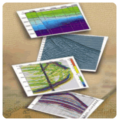 geometries, numerical model building of complex seismic sections and modeling propagation of seismic waves in heterogeneous medium for the scalar, acoustic, elastic and elastic anisotropic wave equations. geometries, numerical model building of complex seismic sections and modeling propagation of seismic waves in heterogeneous medium for the scalar, acoustic, elastic and elastic anisotropic wave equations.
Algorithms use fast and accurate computational scheme based on the finite difference method, which allows effective modeling of arbitrarily complex geological medium, including the combination of solid and liquid state bodies.
Obtained wave fields can be processed, directly within the software, to obtain seismic images with the help of different modifications of the time and depth migration.
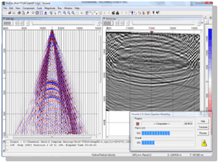 The software package Tesseral 2D is intended for the interactive analysis and examination of depth-velocity models and it easy fits into the survey planning, processing and interpretation of seismic data. The software package Tesseral 2D is intended for the interactive analysis and examination of depth-velocity models and it easy fits into the survey planning, processing and interpretation of seismic data.
It is widely used as an educational tool in the study of wavefield propagation phenomena, survey planning, processing and interpretation of seismic data.
The following software variants are available: Windows Standalone, Windows Network and Linux Cluster.
2D/3D full wave modeling and seismic survey design for oil and gas fields
Tesseral Pro is a professional software 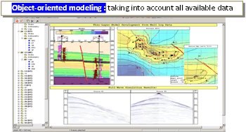 which extends Tesseral 2D for enterprise level application. It proposes additional tools such as 3D survey planning, 3D modeling and elementary 3D processing intended to interactive analysis of deposit exploration operations using geological/geophysical database. which extends Tesseral 2D for enterprise level application. It proposes additional tools such as 3D survey planning, 3D modeling and elementary 3D processing intended to interactive analysis of deposit exploration operations using geological/geophysical database.
The software allows designing multicomponent depth models from well log data, horizon maps, seismic velocity cubes then synthesing shotgathers and supplementary data by 1D, 2D, 2.5D and 3D methods, computing fold and illumination maps for target objects, etc.
Tesseral Pro enables the creation of thin-layered models capable of high precision and modeling feasibility. Along with well log data, the user can enter additional data such as: well's coordinates and inclinometry, stratigraphic arrangements, fault information, horizon maps etc.
WYSIWYG approach enables combining maps, cross-sections, 2D and 3D drawings, multi-parameter models, seismic cross-sections and cubes, pictures and text strings to create high quality plots. Overlay and controlled transparency of fields is supported. Composite documents can be printed or exported in multiple file formats.
Tesseral Engineering is customized for near-surface, much more affordable version of the World's most popular oil & gas full-wave modelling software package Tesseral.
The program allows one to simulate the initial seismic data for media of any complexity in order to test the capabilities of the selected acquisition system for geological
problems solution. Modelling at the work planning step enables to determine the optimal acquisition system, and at the interpretation stage − to make sure that it is adequate
and reliable for particular problem solution. The engineering version of the software package works with 2D models of any length, depth up to 300 m and a maximum number of
channels in the active spread equal to 101, which more than enough covers almost the entire range of shallow seismic tasks.
Tesseral Engineering implements accurate and fast calculations of 2D synthetics using a variety of methods (more than 10), ranging from ray tracing to viscoelastic
modelling, taking into account 3D TTI anisotropy and several 3D fracture systems, which enables performing modelling of arbitrarily complex geological media in the shortest
possible time, including a combination of solids and liquids, with any number of boundaries of any geometry. Flexible toolkit for building a studied medium allows one to use
drilling data or well logs, create continuous layers and closed-loop configurations with a fixed or complex distribution of physical properties, such as P- and S-wave
velocities, density, damping parameters, porosity with fluid properties, fractures, and Thomsen anisotropic parameters. The software supports importing a model from txt
or SEG-Y files and using raster images as a background for drawing model polygons. The modelling method is selected automatically based on the properties of the model, the
problem and the expected results.
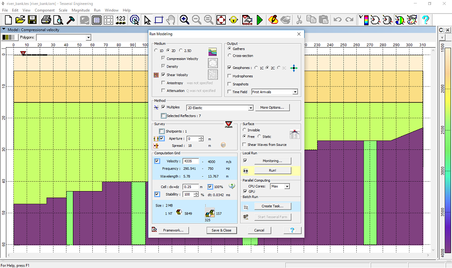
The user has access to various options for acquisition systems - sources and receivers can be located on the surface of a model, in a water column, at the bottom of water
area or in boreholes of any geometry. Each receiver can be defined as a 1/2/3C geophone or hydrophone. Users can set the frequency and signature of the source, assign it
as omnidirectional, directional dipole / monopole, or in the form of symmetric oscillations of lateral stresses of a small volume. It is also possible to simulate a solid
extended source to imitate the propagation of plane waves or exploding horizons, resulting in a time section t0.
When using Tesseral Engineering at the interpretation stage, the user can upload the section obtained as a result of processing real data, add physical properties and
targets (karsts, faults, fracture zones, taliks, etc.) into it, perform modelling and compare the calculated seismic gathers with real ones. Subsequent processing of
synthetic gathers allows determining the reliability of interpretation and the limits of capabilities of the given acquisition system on a specific section when solving
the geological or geotechnical problem.
Tesseral Engineering allows users to flexibly customize the visualization of calculated synthetic gathers, adjust the palette and gain in different ways, add noise,
random time shifts of traces, or simulate receiver grouping. Built-in tools enable to evaluate the dynamics of wave propagation in the geological model and perform
detailed analysis of the seismic record components as well as to determine the features of wanted waves and interference waves on synthetic and real seismic gathers.
It is also possible to sort traces, convert from times to depths and backwards, split or combine seismic gathers and calculate their differences. The calculated synthetic
data is saved in SEG-Y format. The user can also visualize the wave fronts propagation in the model's body, as well as save it in the form of snapshots or videos.
Main features:
- Modelling of all types of waves: converted, surface, tube, multiple
- Frequency, shape, character, direction of the source signal is flexibly adjustable
- Any geometry of boundaries, thin layering, fracturing, gradient media
- Various source-receiver configurations
Tesseral Engineering is a joint development between Tesseral Technologies Inc., Brend-Vik Canada Inc. and
Geodevice.
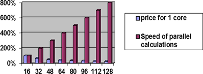
Multiprocessor PCs and servers.
Parallel computing on multiple Windows PCs using network version and on computer clusters under Linux or Windows.
Computing acceleration by general-purpose graphic units (GPU) is provided as option for 2D-2C, 2.5D-3C and 3D-3C modeling.
In the 3D-3C case a wavefield distibution among multiple computer nodes and GPUs makes it possible to solve big problems for wich single computer memory is insuficient.
For complex geology the reasonable simulation time is provided by GPUs with 25-50-fold speedup over a similar serial program.
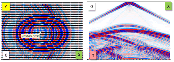
Modeling of the 3D seismic wavefield propagation effects
In contrast to the 2D modeling, waves in 2.5D modeling propagate in a 3D medium and are described with 3D equations. In this case, the dynamic of the wavefield is preserved and creates the possibility to model 3D-3C areal gathers for surface seismic and VSP.
2.5D-3C modeling enables to specify true elastic model; consider the thin-layering effects (quasi-anisotropy, dispersion and dependence of wave propagation velocity on frequency), fracturing and anisotropy.
2.5D-3C modeling allows considering complex geological conditions, but in contrast with the full 3D modeling, it requires some simplification of the 3D medium model: the medium parameters are assumed to be constant along Y axis (usually oriented along structural strike). However the anisotropy can be arbitrary and take into account several fracture systems with different spatial orientations.
In contrast with 2.5D-3C, 3D-3C Acoustic and Elastic modelling allows approximating wave propagation in conditions of realistically heterogeneous (in all 3 directions X-, Z- and Y-) medium. This modelling can be applied to the objects like reefs, salt domes, different kinds of collapse/breakthrough chimneys or steeply inclined faults etc. in the areas where an accurate 3D reservoir characterization is required.
Note*: 2.5-3D-3C Full-wave (finite-difference) modelling, due to its computational intensity, is based on Parallel Options including multi-core, -node, -GPU solutions allowing to run such simulations in a feasible turnaround time.
|


